JV with Walkabout Resources in Slieve Gallion, Northern Ireland
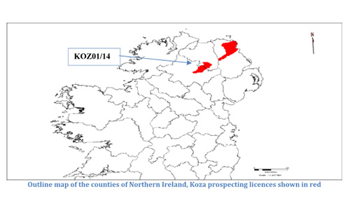
Koza Ltd holds prospecting licence options from Crown Estate Commissioners (CEC) for gold and silver, started June 2015, and base metals options started July 2016 from Department of Economy (DoE), known as KOZ01/16 at Slieve Gallion, County Londonderry and County Tyrone. These licences are awarded for 6 year terms with options of renewal. The Slieve Gallion licence (KOZ01/16) covers an area of 250 km2. Slieve Gallion is the eastern most mountain of the Sperrin’s range and comprises of two, broad, upland peaks and surrounding lowland area.
Several phases of exploration have been carried out historically beginning with the Irish survey programme of 1865, cumulating with the Tellus survey (2008), and PhD work conducted by Steve Hollis (2010-2014). Previous exploration efforts have been frustrated in the discovery of significant ore deposits due to thickness of glacial sediments and peat cover, especially in the central and western areas. However, new techniques including fusion analysis geochemistry may provide a breakthrough, vectoring to deposits that have little or no surface expression. A total of 233 soil samples, 33 stream sediment samples and 36 rock samples have been collected and analysed, as well as the data capture, or digitisation, of all historic exploration activities previously conducted within the licence.
JV with Walkabout Resources in Antrim, Northern Ireland
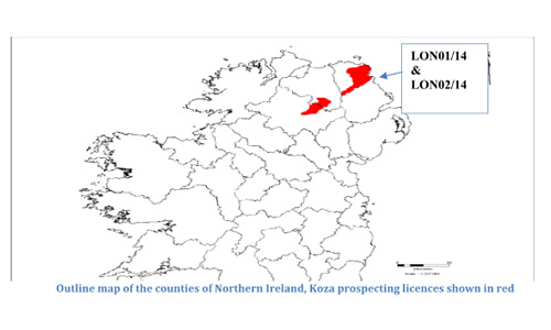
Koza Ltd is actively exploring for minerals and metals on 750km2 area of ground held under option agreement from the Department for the Economy (Northern Ireland) and Crown Estate Commissioners (CEC). Mineral prospecting Licences’ (MPL) LON01/14 & LON0/14 (known as the Antrim Project) are situated in County Antrim, Northern Ireland, UK. Koza Ltd entered into a joint venture agreement with Walkabout. Both properties are contiguous and accessible from a main office located in Antrim town (40 minutes), and from Belfast (60 minutes).
Several anomalous areas defined by regional stream and soil samples followed up with soil sampling with some good results. Narrow weakly gold mineralized veins identified along strike of drill area at Shelton Bridge warrants mapping, soil sampling and trench/drilling.
JV with GreenOre in Aberdeenshire, Scotland
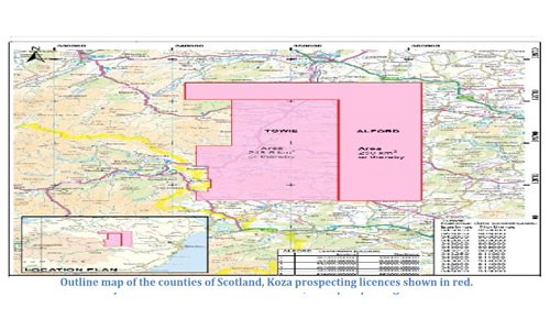
In 2015 Koza Ltd partnered with GreenOre Gold Plc with the signing of a joint venture agreement. The licence areas, referred to simply as ‘Towie’ and ‘Alford’ are located approximately 50km West of Aberdeen and covers combined 500 km2 area in rural farmland and forest plantations. Prior to the agreement, GreenOre have been exploring for gold and silver near the hamlet of Towie in Aberdeenshire, Scotland. Towie and Alford licences have been granted for a 6-year period from the Crown Estate.
Trenching is progressing well and has intersected interesting geology in terms of alteration and lithology. Trenching has been completed at Scar Hill area and stream sediment sampling completed over both licences. Obtaining 53.8g/t Au in float in a new area was the highlight of 2016 and proves the existence of unknown high grade quartz veins throughout the area. Promising results from the stream sediment programme indicates further gold mineralization is present within the 500 km2 prospecting area. Stream sediment analysis has revealed an extension of the known mineralised at Scar Hill towards the East.
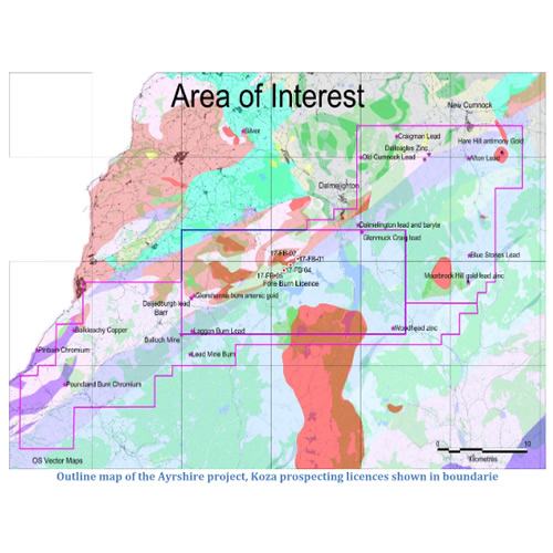
JV with GreenOre in Ayrshire, Scotland
In 2017 Koza Ltd partnered with GreenOre Gold Plc with the signing of another joint venture agreement. GreenOre awarded an option to a 250 km2 area mining lease from the Crown Estate in 2016. The area has a good location in regards to infrastructure, environment and land ownership. In the past, 3 main outcrops of gold discovered in government owned land (Forestry Commission). Historic bedrock samples high grade: up to 57g/t Au. Historic Drill core assay returned 51g/t Au over 25cm. Permits currently being sought for drilling.
All of the new and historic drill data has been compiled. The results have been reviewed by technical team and a further 4000m of drilling will be conducted between the Eastern and Western Anomalies in 2018 with some scout drilling around the perifery. This work would follow some ground geophysics.
Poison Project in Nevada, USA
Nevada is ranked the 3rd best jurisdiction in the world for endowment potential and ability to undertake exploration and mining. The Nevada project fits Koza Ltd.’s strategy of building a portfolio of early to advanced stage exploration properties with the long-term goal of having a central ore processing plant receiving ore from various satellite projects.
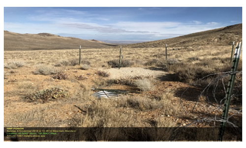
Poison is an early stage exploration property in a known epithermal gold-silver region (Southern Idaho and Nevada). Mineralisation can be traced over 1.5 km of length in two, and possibly three subparallel trends. The maximum gold grade in surface rock sampling is 13 g/t Au (historic mullock pile). The work programme for the Poison area has started in 2017.
Goldfield West Project in Nevada, USA
The Goldfield West (GFW) property is comprised of 105 unpatented mining claims covering a total of 2,100 acres. The project is located about 3 miles west of Goldfield, Nevada and approximately 4 miles west-southwest of the historic Goldfield mining camp. The Goldfield West property is underlain by Tertiary felsic volcanic rocks and an epiclastic volcanic sequence consisting of tuffaceous sandstones and volcanic conglomerates.
Two styles of gold mineralization identified by work to date include one hosted by quartz veins and a second in permeable felsic volcanic tuff and volcanoclastic sediments. Bonanza style, high grade gold bearing veins are the primary targets. The quartz-alunite-sulfide veins hosting high-grade mineralization in the main Goldfield district are identical in appearance to samples from GFW. The second style mineralization targeted at GFW is represented by widespread, low grade gold mineralization hosted by permeable tuffaceous sediments and volcanically derived sediments.
Drilling has encountered significant thicknesses of low grade mineralization (see attached results) with intermittent higher-grade intervals. These results confirm the existence of one or more gold-bearing hydrothermal systems associated with structural preparation, argillisation and silicification of host rocks. Three targets (Nevada Eagle, South and Centre) have a combined low-grade resource of approximately 100,000 ounces of gold (depending on cut-off). The resource areas are generally open ended and little work has been completed between these resources. Continued exploration of this system is recommended to define the size and grade of the gold mineralization. Nearby deposits include Waterton’s Goldfield/Gemfield deposits containing a reported 4.6 million ounces of past gold production and an additional reported 2.5 million ounces of gold reserves. The property has the potential to host +1 million ounces of gold in Tertiary age rhyolite flow domes, volcanoclastics and basement Palaeozoic rocks. Although the gold in the system is generally low grade (~0.65 g/t) surface samples collected from old workings and outcrops have exceeded 15 g/t gold while drilling has encountered up to 23 g/t gold.
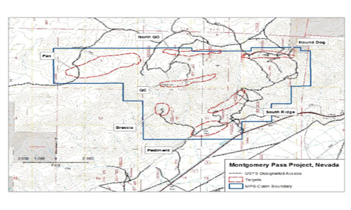
Montgomery Pass Project in Nevada, USA
The Montgomery Pass Claims project is located within the Buena Vista Mining District in southwestern Mineral County, Nevada, USA approximately 161 kilometers west of Tonopah, Nevada and 72.4 kilometers north-northeast of Bishop, California. The project area comprises nine targets bearing characteristics based on geologic setting or mineral occurrence. Each of these areas has been investigated either historically with shallow prospects or underground workings or by modern sampling-geologic mapping- drilling.
A database has been compiled from the previous work on the property comprising over 1200 rock chip samples, 150 soil samples and 98 relatively shallow drill holes combined with geologic mapping of surface and underground workings. Compilation of these historic exploration efforts identified ore grade gold and silver values occurring in surface sampling and shallow, wide-spaced drilling. Five of the eight target areas have had modest drill testing. The resulting compilation of surface, underground and drilling results clearly indicates that further exploration at Montgomery Pass is warranted.
The Project fits Koza Ltd.’s strategy of building a portfolio of early to advanced stage exploration properties with the long-term goal of having a central ore processing plant receiving ore from various satellite projects. Also, Koza Ltd. has recognised the potential for high grade vein style mineralisation within the property.
